Urban Deployments

City settings and mobility challenges

Barcelona, located in northeast of Spain, is a big city populated with over 1,5 million people. The city is the capital of the Catalonia region and comprises a road network consisting of multiple vertical, horizontal and diagonal arteries, connecting different parts of the city, and a road ring. It is well-known for the number of motorcycles running in the streets, but other challenges have also been identified, especially related to safety.

Moreover, the connections between Barcelona and neighbouring cities are very crowded with cars on a daily basis, which also raises a need to cover them to improve the inter-urban mobility.

C-ITS services

The C-ITS services which have been implemented in Barcelona focus on safety and traffic efficiency, as drivers are provided with notifications aiming to improve attentiveness, inform about network conditions, and promote eco-friendly driving.

The services Road Works Warning, Road Hazard Warning, Green Light Optimal Speed Advisory, Signal Violation Warning, Flexible Infrastructure, In-Vehicle Signage, Motorcycle Approaching Indication, Warning System for Vulnerable Road Users, Emergency Vehicle Warning, and Probe Vehicle Data are implemented at large-scale, covering the entire city area as well as the main arteries connecting with other cities.

All services operations are currently supported by cellular communication technology (4G LTE) enjoyable with Android smartphones.

C-ITS infrastructure

The C-ITS systems in Barcelona are already fed by multiple data sources from different organizations, infrastructures and devices. Traffic lights, emergency vehicles, cameras, digital panels, open data, probe data, etc. are the sources that enable the C-ITS services in the city.

All this data sources are handled by the IDIADA Service Provider, which fuses them, converts to C-ITS information and disseminates to the relevant vehicles/users using the app.

C-ITS App

The app providing cellular communication-based C-ITS services to end-users is developed by IDIADA and is one single free app giving access to all the C-ITS services implemented in the road network of Barcelona for drivers, motorcyclists and cyclists. The app is working in background mode minimizing the user interaction and allowing to use the preferred navigation apps (i.e.: Google Maps, Waze, etc.) while the C-ITS alerts are shown on top of everything only when necessary. Moreover, the app provides interoperability as users can experience common C-ITS services in other cities where these services are applicable. The app is available in Spanish and English languages in the Google Play Store.Barcelona C-MobILE App

End-users engagement

The end-users of C-ITS services in Barcelona are regular drivers. The app is used exclusively by the citizens (drivers, motorcyclists and cyclists). There are no users’ organizations involved.

Local partnerships

Local partners comprise of parties from the public as well as the private sector.

  • IDIADA: Leader of the deployment of the C-ITS services in Barcelona, leading also technical and dissemination activities.
  • Barcelona City Council: Contributed to the organization and support of the deployment in general. In particular, Barcelona has provided all open data from the city, the traffic lights’ information and has collaborated actively in the implementation of the EVW using firefighters’ vehicles.
  • RACC: Contributed to the user engagement and different dissemination activities carried on during the project. RACC has been the main dissemination entity for the Barcelona deployment in order to bring users onboard. Moreover, information of the traffic status is also reported by them.
  • Piaggio: Contributed on identifying potential motorcyclists (incl. offering free installation of the Piaggio PMP device), on the specifications for the Motorcycle Approaching Indication service and also on dissemination activities.
  • Servei Català de Trànsit: Offering digital panels and real-time traffic status information for the Barcelona metropolitan area.
  • Tunels de Barcelona-Cadí: Offering real-time data of the lane status and speed limits of the tunnels. This allows offering pre-warnings to the users about to enter in the Tunel de Vallvidrera.
  • ADASA: Contributed on the implementation in the Barcelona City Council internal systems for the EVW service.

City settings and mobility challenges

Bilbao is the capital of the county called Bizkaia, Spain, and it could be considered as the industrial and financial capital of the Basque Country. With an area of 41,60 km2 and around 355,000 inhabitants, Bilbao is located right in the heart of Greater Bilbao, which is a metropolitan area that extends along the estuary of the Nervión River with a population close to 1 million.

Every day, 544,600 external movements with origin or destination Bilbao are produced. More than a half of the incoming people use the public transport (train or bus) and 2/3 of the outgoing movements are carried out by private car. Meanwhile most of the 826,500 daily internal trips are performed by walking.

Urban transformation carried out by the city has helped to balance the urban landscape to the modal split of the city and provide a friendly environment for pedestrians with: wider pavements; reduction of on street car parking in the city centre; traffic light control system to cater to pedestrians; promenades for walking and cycling.

Bilbao has been working on the improvement of the public transport. The system that supports the exploitation of the urban bus network was developed under the objectives of improving the quality of the service, the network exploitation and the working conditions. Bilbao has also developed an open data platform (Co-Cities project) to offer static and dynamic information about public transport, on street parking and traffic.

More information about the Deployment Site is available in https://labur.eus/cmobileBilbao

C-ITS services

The C-ITS services which have been implemented in Bilbao focus on safety and traffic & parking efficiency, as drivers are provided with notifications aiming to improve attentiveness, inform about network conditions, parking availability, and promote eco-friendly driving.

The services Road Works Warning, Road Hazard Warning, Motorway Parking Availability are implemented in large-scale, covering areas entire city of Bilbao as well as the intermodal route of the Northern Peninsula.

C-ITS services which are implemented in limited scale or as proof of concept are Urban Parking Availability and Blind Spot Detection. All services operations are currently supported by cellular communication technology (4G LTE) enjoyable with Android devices.

C-ITS infrastructure

The C-ITS services in Bilbao rely in multiple data sources from different organizations, infrastructures and devices. Those are mainly collected at the Open Data platform of the city.

Regarding back-end systems, a GeoMessaging Platform developed by CEIT is responsible for the generation of the C-ITS messages and its broadcasting taking into account the end-users location.

C-ITS App

These five services deployed in Bilbao use four independent applications since the targeted users (cyclist, private car drivers and truck drivers) and scope are different for each one.  BSD and MPA apps are developed by CEIT, UPA app by GERTEK and RWW/RHW is using NeoGLS’ app. All apps are free and provide cellular communication-based C-ITS services to end-users. All of them provide interoperability as users can experience common C-ITS services in other cities where these services are applicable. MPA and BSD (PoC) apps are available in Spanish and English languages in the Google Play Store under the name of C-MobILE Bilbao. To enjoy RWW/RHW services it is necessary to download CTD – Connected Mobility app. Check the below links.

BSD

CTVi MPA

CTD – Connected Mobility

End-users engagement

The end-users of C-ITS services in Bilbao are mostly regular drivers. The UPA, BSD and RWW/RHW services are used exclusively by the citizens (drivers and cyclists). However, for MPA app CTVi users (truck drivers) are involved.

Local partnerships

Local partners engaged include public and private organisations, namely:

  • CEIT: Services deployment leader. It deploys MPA and BSD services as well as the GeoMessaging platform of the city for the C-ITS services.
  • Bilbao City Council: Public authority contributed with the necessary means and connections to implement, deploy and successfully test the services in the city of Bilbao. It also manages data providers.
  • MLC: The Mobility Cluster contributed to the different dissemination activities.
  • Gertek: Responsible of designing UPA service App and the API related with the communications between Bilbao council’s applications and back-office.
  • Kapsch: This Enterprise contributed with the management of the information of the back-office related with UPA and RWW/RHW.

City settings and mobility challenges

Bordeaux is located in the South West of France; it comprises five authority areas and is home to almost one million people. It is an important European hub and is managed by 2 innovative urban and inter-urban road management systems. It also has an important international port.

The ring road of Bordeaux is managed by the road operator DIR Atlantique while the urban area is managed by Bordeaux Métropole and the city of Bordeaux. An important project named Alienor 2 is on-going and has an ambitious goal of providing interoperability between the urban and inter-urban systems, data and mobility functionalities.

Bordeaux is greatly congested since the city is in the middle of an important corridor for reaching Spain and Portugal. Furthermore, many inhabitants which work in Bordeaux live outside of the city. Finally, the Bordeaux region has many touristic attractions including wine areas and beaches. This congestion issue is the main mobility concern of Bordeaux. Many actions have been finalized or are on-going like for example transforming the 2-lane ring-road to 3 lanes in the 2 directions. Also, by deploying several tramway lines, car sharing, bicycle sharing and many more in order to push people to prefer public transport instead of the car. Bordeaux Métropole and DIR Atlantique are also actively deploying C-ITS use cases through projects like C-The Difference, C-MobILE, Scoop and C-Roads.

C-ITS services

The services Motorway and Urban Parking Availability, Road Works Warning, Road Hazard Warning, Emergency Vehicle Warning, Signal Violation Warning, Green Priority, GLOSA, Flexible Infrastructure, In-Vehicle Signage, Mode & Trip Time Advice, and Probe Vehicle Data are deployed in Bordeaux as large scale deployment through the android App “CTD – Connected Mobility”. The App displays the information provided by these services with pop-ups appearing above the favourite user navigation app like Waze or TomTom. All the services are available by cellular long distance communication and some of them are completed by ITS-G5 short range communication. Furthermore, the services Warning System for Pedestrians, Cooperative Traffic Light for Pedestrians, Emergency Brake Light, Cooperative Adaptive Cruise Control, Slow or Stationary Vehicle Warning, Motorcycle Approaching Indication, and Blind Spot Detection have been developed as proof of concept and essentially based on ITS-G5 communication technology. As for the locations of implementation, the cellular services are available in the entire city of Bordeaux including the ring road.

C-ITS infrastructure

The C-ITS services in Bordeaux rely on multiple data sources from different road operators. DIRA provides VMS information for the ring-road and TIPI provides road events. Bordeaux Métropole provides multiple data essentially through open data. Atlandes TMC provides rest area and VMS information for the A63 from Bordeaux to Spain.

Regarding back-end systems, a GeoMessaging Platform developed by NeoGLS is responsible for the generation of the C-ITS messages and its broadcasting taking into account the end-user’s location. ITS-G5 Roadside Units and On-Board Units developed by NeoGLS are deployed in the north of Bordeaux and on emergency vehicles.

C-ITS App

The large-scale use cases are available in Bordeaux through a unique Android app named « CTD – Connected Mobility ». The app can be downloaded free of charge from the Play Store or by following this link : https://bit.ly/ctd-connected-mobility. An iOS version is currently under development and will be published in December 2021. The main functionalities are the following:

  • Designed for car drivers
  • Use in parallel with a GPS navigation app
  • Providing information and warnings while driving
  • Alerts displayed over other apps
  • Selection of enabled services
  • 3 languages available (FR, EN, ES)

End-users engagement

The Android App in Bordeaux is available to anyone free of charge on the Google Play Store. The download is anonymous but by analyzing the comments it is clear that the users are essentially light vehicle drivers in Bordeaux and truck drivers on the ring-road and on the highway. The Automobile Club South West through FIA and the Aquitaine cluster Digital Aquitaine support the dissemination of the App.

Local partnerships

  • NeoGLS: Deployment leader and provider of the C-ITS material and software necessary for the deployment of the C-ITS use cases in Bordeaux.
  • Gertrude: Responsible for the management of the traffic lights in Bordeaux. Supporting the GLOSA and Green Priority services, as these require an interaction with the traffic lights managing system.

City settings and mobility challenges

Copenhagen, the capital of Denmark, is the largest city in Denmark with a population of more than 1 million residents in the Greater Copenhagen Area. One key characteristic of the City of Copenhagen is the large share of cyclists compared to other modes of transport. More than 60% of residents in the City of Copenhagen commute by bike, while more than 40% of all commuting trips (including commuting by non-residents) are done by bike.

The main mobility challenges therefore also relate to the modal split, such as increasing cycling, relieving congestion both for cars and on the bike lanes, increasing efficiency of goods delivery and improved traffic and road information to all users regardless of mode.

The City of Copenhagen has engaged in various ITS and C-ITS projects, but for the first time the main contribution of Copenhagen is an emphasis on creating C-ITS services for cyclists. In this way we strive to generate awareness on international and market level of the potential of cycling as the mode of transport of the future already here.

C-ITS services

The C-ITS services implemented in the City of Copenhagen are focused on traffic safety, convenience and efficiency. Cyclists and drivers are provided with information improving their decision-making ability without distracting them from the traffic situation and their surroundings.

The services Green Light Optimal Speed Advisory (GLOSA), Road Works Warning, Road Hazard Warning and Green Priority are implemented on a large scale, covering the entire city of Copenhagen or as much as technology allows.

The Warning Systems for Pedestrians service is implemented in limited scale as a proof of concept.

All services operations – except Green Priority – are currently supported by cellular communication technologies (3G or 4G), while Green Priority and GLOSA are also supported by direct ITS-G5 communication technology.

C-ITS infrastructure

The necessary data for C-ITS services operation in Copenhagen rely on fusion of multisource data collected from the road network. Equipment installations include 140 Traffic Light Controllers, around 40 road temperature sensors, and 49 Roadside Units (RSU) for ITS-G5 communication.

C-ITS App

The app providing cellular communication-based C-ITS services to end-users is developed by Technolution, and is one single free app giving access to all the cellular C-ITS services implemented in the road network of Copenhagen. The app combines a user-friendly interface and intelligence features, in order to improve driving comfort. Moreover, the app provides interoperability as users can experience common C-ITS services in other cities where these services are applicable. The GreenCatch app is available in Google Play Store.

End-users engagement

The end-users of C-ITS services in Copenhagen comprise of cyclists, drivers and professional drivers. The cyclists and drivers will be the general public and road users in Copenhagen. While the professional drivers are the staff of the Technical and Environmental Administration of the City of Copenhagen.

Local partnerships

Local partners engaged include the Cyclists Association and the Truck Drivers Association, and naturally the individual road users and users of the App.

City settings and mobility challenges

Situated in Tyne and Wear, in the north-east of England, Newcastle has a population of approximately 295,000, within a wider metropolitan area of approximately 1 million. The area has significant issues with congestion at peak times and consequent issues with air quality. Newcastle City Council is the lead authority for the Tyne and Wear Urban Traffic Management Control centre (UTMC), which includes Gateshead, North and South Tyneside and the City of Sunderland as well as the City of Newcastle. The city has a good mode share of public transport. However, the bus service often experiences delays at peak times, reducing attractiveness. Emergency services, freight and taxis also experience delays that impede their effectiveness. The city wishes to be at the forefront of innovative transport investment and sees C-ITS as part of the solution.

C-ITS services

The equipped locations in Newcastle city are the Gosforth Corridor and the Chillingham Road zone (former Compass4D). The Gosforth Corridor is an important arterial route north from Newcastle city centre; the Chillingham Road zone covers part of an easterly arterial corridor and a north-south suburban route.

Newcastle offers both ITS-G5 and cellular (4G) service bundles.

4G service bundle: this includes RWW/RHW which are region-wide services (i.e. not restricted to equipped routes but available anywhere in the Tyne and Wear region) utilizing DENM messaging, and IVS (speed limit information), restricted to the Gosforth Corridor, and utilizing IVI messaging. The City Council and Siemens (systems integrator) have recently added GLOSA 4G to the cellular bundle at one intersection, with the potential to add further intersections in the future.

ITS-G5 service bundle (GLOSA/GP) are currently available on the Gosforth Corridor, having been deployed as part of a previous project. These services utilize Siemens roadside infrastructure, Dynniq OBUs and a bespoke Zircon HMI. The service has been developed for Arriva express buses to enhance journey reliability. The old Compass4D routes (Chillingham Road zone) is now scheduled for upgrade to ETSI 2019 standard by Siemens. Taxis and local authority vehicles will be equipped with Cohda OBUs.

Probe vehicle data from the Gosforth Corridor is also provided for the benefit of the city’s urban traffic manager (UTMC).

The main focus of the C-ITS services in Newcastle is network efficiency and operational efficiency for specific fleet vehicle types. An added benefit comes in the form of eco-driving from these service bundles which is expected to lead to carbon savings.

C-ITS infrastructure

The RWW/RHW services are derived from existing region-wide data sources converted into DENM messages and delivered to users via app (NeoGLS). The IVS service is a static speed limit information service on one route, Gosforth Corridor, converted to an IVI message format and then delivered to users via the same app. In order to ensure stability of these services for ultimately many users, Zircon (a contractor to Newcastle City Council) has developed a robust cloud-based server and bridge to the NeoGLS geo-messaging server. The Newcastle systems integrator, Siemens UK, also aims to deliver GLOSA services on selected routes via 4G later in 2020. These services are interoperable with other cities.

The GLOSA/GP services are currently delivered to Arriva express buses on the Gosforth Corridor:

18 RSUs have been deployed by Siemens UK. The route includes pedestrian crossings as well as standard priority traffic lights. It uses the signal plan and the speed / location of the vehicle to work out what the optimal speed would be to get through a green light, then communicates this to driver. GLOSA can be used with or without green light priority. A further 21 roadside units exist on the Chillingham Road zone but are to be upgraded to ETSI 2019 standard.

Data is generated from the Dynniq OBUs and the Zircon HMIs. Work is currently underway to deliver the appropriate CAM format in line with common specifications.

C-ITS App

The main app used in Newcastle that is interoperable with other cities is the NeoGLS app to deliver road works warning, road hazard warning and in vehicle signage. GLOSA will also ultimately be delivered via this app.

The first beneficiaries will be North East Ambulance Service (NEAS) non-emergency vehicles (so-called patient transfer vehicles) that take people to routine appointments at hospitals. Eventually the app will be available to any user with an Android device who downloads the app from Play Store, including all fleet users, and potentially any member of the public.
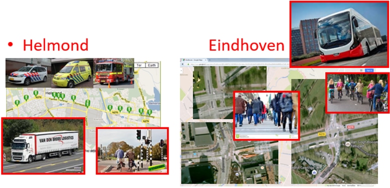
End-users engagement

C-ITS services in Newcastle are targeted at fleet operators as part of the City Council’s policy to prioritise public transport and emergency services ahead of private traffic. This approach informed the legacy C-ITS projects in Newcastle which are centred on ITS-G5 technology. Beneficiaries include Arriva express buses, North East Ambulance Service (NEAS) non-emergency vehicles, and NODA taxis.

Individual drivers are engaged via operators: currently 140 bus drivers (35 vehicles), 20 non-emergency ambulance drivers (13 vehicles).

Newcastle is also interested in the potential of C-ITS solutions for VRUs, particularly pedestrian safety. This is to be a focus of proof of concept and feasibility studies.

C-ITS services via cellular communications are targeted firstly at the NEAS, with some university and local authority drivers also engaging. However, the development of cellular services is regarded as a ‘game changer’ for delivery of key services to many users. These services are available through the NeoGLS app (CTD), and anyone with an android device can download the app from Google Play Store.

Local partnerships

Newcastle enjoys collaboration between many partners.

  • Newcastle City Council: Local Authority and responsible legally for the management of roads within the city. Manages the C-ITS projects and provides an interface between local partners. Traffic Signals Group is a beneficiary at NCC.
  • Tyne and Wear Urban Traffic Management Centre (UTMC or TMC): Responsible for the technical back-office including cloud hosted open data platform that provides RHW/RWW services. Responsible for network management within the wider sub-region (population 1 million)
  • Newcastle University: Acting as deployment site leader to support the Newcastle City Council in the provision of data management and evaluation
  • North East Ambulance Service: Key beneficiary for its non-emergency patient transfer service vehicles
  • Arriva Buses (Deutsche Bahn): Beneficiary of C-ITS services
  • NODA Taxis: Beneficiary of C-ITS services
  • Siemens: Developer of the Roadside Units and the majority of traffic services infrastructure in the North East. Overall systems integrator.
  • Dynniq UK: Supplier of On-Board Units (OBUs)
  • Zircon: Contractor engaged to develop HMI for previous project to equip Arriva buses; now working with Siemens to integrate cellular services
  • NeoGLS: Provider of Geo-Messaging and App-based cellular services for Newcastle
  • Highways England: National and regional road operator engaging with the City regarding future C-ITS

City settings and mobility challenges

North-Brabant is a province, located in the southeast of The Netherlands, of just over 5.000 km2 with 2,5 million inhabitants. Important motorways for transport from the harbour of Rotterdam, leading to (south and east) Germany, are running through North-Brabant. These motorways are also crowded with commuting traffic between the larger cities Tilburg, Eindhoven, and Venlo as well as between the south of the Netherlands and the more densely populated western part of The Netherlands. Cycling is also a popular way of commuting in The Netherlands, especially within the cities. Due to the traffic being mixed in the cities, cyclists and pedestrians are at risk of being hit by a vehicle, despite all the infrastructure. The motorways as well as the large cities in North-Brabant, like Helmond, Eindhoven and Tilburg, suffer from traffic jams and congestions. This causes economic losses as well as citizens suffering from polluted air.

North-Brabant considers C-ITS solutions a possibility to mitigate these problems, and therefor built several pilot sites where C-ITS services (aimed at increasing safety, mitigating congestion, and/or reducing environmental issues) are being tested.

Eindhoven and Helmond are the two cities in the southeast of the province of Noord-Brabant involved with urban deployments. In terms of population, Eindhoven has been the fifth municipality of the Netherlands since 1961. Eindhoven has 231,642 inhabitants (January 1, 2019) on an area of 88.84 km². Helmond has 92,420 inhabitants on an area of 54.57 km².

C-ITS services

In North Brabant 9 C-ITS services are deployed based on both ITS-G5 and cellular communication technologies. Services such as Road works warning, Road hazard warning, Signal violation warning, GLOSA are provided to car drivers using a Smartphone app with cellular technologies. Green priority is provided both to truck drivers and emergency vehicles and these services are implemented through ITS-G5 communication technologies.
The service Emergency Vehicle Warning is provided via OBUs (ITS-G5) installed in trucks. Passing cyclists at an instrumented intersection will experience the service Cooperative traffic light for VRU, which uses camera detections to provide green priority for large cyclists groups. The service Urban Cooperative Adaptive Cruise Control (U-CACC) connects to equipped intersections using the ITS-G5 network to ensure safe automated driving and automated stopping at traffic lights.


C-ITS infrastructure

In North-Brabant both cellular and ITS-G5 communication technologies are deployed for to provide road users with C-ITS services.
The Cloud hosted platform of the NDW keeps a live tracking of all road concerns, including the position of road works and other relevant road hazards. At the same time, it generates the corresponding ITS-G5 messages according to the situations detected.
The RSU is connected to the traffic light controller (TLC) to acquire Signal Phase and Timing (SPaT) information. GLOSA, Signal Violation Warning and Green Priority services run on the RSUs and use the information from the TLC to encode MAP/SPaT and DENM information. For the Signal Violation Warning the CAM messages of the vehicles are used to evaluate if a vehicle is (about to) violate the red light. There is also an interface to accept the CAM messages from the TMC level for the service Cooperative Traffic Light for Vulnerable Road Users.
In the C-ITS deployments of North-Brabant the drivers use a smartphone in order to receive information from the Local Operational Web Server related to GLOSA, traffic and road hazards. An ITS-G5 OBU is used for Green Priority services.
The smartphone provides regular updates of their location (using a geofencing) to keep the web server updated of the position of the vehicles.

C-ITS App

An Android app is being tested (only by employees of TNO and the City of Helmond) in Helmond, based on cellular communication, developed by Applus+ IDIADA. Users can use their preferred navigation app (Google Maps, MAPS.ME, etc.) while this app is functioning in the background.
The following services are being tested in the North-Brabant app: Road Works Warning, Road Hazard Warning, GLOSA, Signal Violation Warning. For ITS-G5 services an OBU, and App as HMI is used from Dynniq.

End-users engagement

The end users in Eindhoven consist of various cycle-lane users (including bicycles, wheelchairs, mobility-scooters, scooters, etc.), taxi drivers and pedestrians at the Blind Spot Detection and Warning System for Pedestrian service at the Central Station location.
In Helmond the end users are the fire brigade and police services, and several transport companies (Van den Broek, Lavans, Hurkmans) for testing the Green Priority and the Emergency Vehicle Warning services, plus the TNO and City of Helmond employees for testing the smartphone App provided by IDIADA.

Local partnerships

The following stakeholders collaborate in the DS of North Brabant service various purposes. Strategic partners such as:
Eindhoven City Council: Public authority; providing the necessary means and connections to implement, deploy and successfully test the services in the region of Eindhoven, and managing data providers.
Helmond City Council: Public authority providing the necessary means and connections to implement, deploy and successfully test the services in the city of Helmond and the highway A270, and managing data providers, and providing access to emergency vehicles.

Development partners such as:
Dynniq: C-ITS system provider
Macq SA: VRU protection systems; providing camera detection system, and image processing algorithms
TU/e: developing architectures for mobility
TNO: developing and deploying urban CACC and Truck Platooning
IDIADA: developing Apps for C-ITS services

City settings and mobility challenges

Thessaloniki, located in northern Greece, is the second largest city in Greece with over 1 million inhabitants in its metropolitan area (Region of Central Macedonia). The city consists of highly densely populated areas and a complex urban and interurban road network, while the total number of vehicles exceeds 777.544, including private cars, heavy vehicles and motorcycles.

The main mobility challenges relate to traffic congestion, road safety and accidents, parking management, as well as environmental pollution. Thessaloniki has been engaged in various initiatives and projects related to connected and cooperative mobility in an attempt to address mobility problems and provide smart solutions and services to citizens. More information is available online at https://cmobile.imet.gr/.

C-ITS services

The C-ITS services which have been implemented in Thessaloniki focus on safety and traffic efficiency, as drivers are provided with notifications aiming to improve attentiveness, inform about network conditions, and promote eco-friendly driving.

The services Road Works Warning, Road Hazard Warning, Green Light Optimal Speed Advisory (GLOSA), Flexible Infrastructure, In-Vehicle Signage, Mode and Trip Time Advice, and Probe Vehicle Data are implemented in large-scale, covering areas of the Central Business District of the city, the Peripheral Ring Road, as well as the eastern and western entrance to the city.

C-ITS services which are implemented in limited scale or as proof of concept are Emergency Vehicle Warning, Signal Violation Warning, Warning System for Pedestrian, Green Priority, and Cooperative Traffic Light for Pedestrian.

All services operations are currently supported by cellular communication technologies (LTE) with future extensions targeting to integrate wireless short-range communications (ITS-G5).

C-ITS infrastructure

The necessary data for C-ITS services operation in Thessaloniki rely on fusion of multisource data collected from the road network. Equipment installations include loop detectors, closed-circuit television cameras, and Variable Message Signs (VMS), while data are collected also from vehicles (that is Probe Vehicle Data or Floating Car Data).

Regarding back-end systems, a GeoMessaging Platform developed by CERTH-HIT is used to broadcast C-ITS messages taking into account the location of service’ end-users. In addition, the CTMaaS tool developed by CERTH-HIT is provided to the Traffic Management Centre of the city with the purpose to integrate the C-ITS services in daily traffic management.

C-ITS App

The app providing cellular communication-based C-ITS services to end-users is developed by CERTH-HIT, and is one single free app giving access to all the C-ITS services implemented in the road network of Thessaloniki. The app combines a user-friendly interface and intelligence features, in order to improve driving comfort. Moreover, the app provides interoperability as users can experience common C-ITS services in other cities where these services are applicable. The App is available in Google Play Store.

End-users engagement

The end-users of C-ITS services in Thessaloniki comprise of regular and professional drivers. Regular drivers include employees from CERTH and the Region of Central Macedonia (RCM) as well as staff and students of the Aristotle University of Thessaloniki (AUTH). Individual citizens (private drivers) can also download and use the free App. Regarding professional drivers, around 1000 taxi drivers from the company Taxiway are provided with the App.

Local partnerships

Local partners included public and private organisations, namely:

  • The Region of Central Macedonia (RCM) is the regional governmental authority that is responsible for traffic management and the purchase and operation of all related equipment, such as field and back-end systems, controllers, VMSs.
  • Taxiway is a private company and taxi fleet operator, which provides taxi services to citizens. Traffic Technique is a contractor and commercial company, specializing in the design, supply, installation and technical-support of road-traffic management and control systems, including intersection traffic control, traffic detection and counting, ITS solutions, and parking management systems.
  • Swarco Hellas is a company providing innovative Infomobility Services and Intelligent Transportation System Solutions. The company develops and offers Content & Information services for the traffic and transport sector, and it also integrates and implements a wide range of ITS applications, including urban traffic control and traffic monitoring systems.
  • Other stakeholders supporting deployment efforts are the Ministry of Infrastructure, Transport and Networks (YME) and the Aristotle University of Thessaloniki (AUTH).

City settings and mobility challenges

Vigo is a city of almost 300,000 inhabitants located in the autonomous community of Galicia, in the northwest of Spain. Industrial centre of Galicia and reference harbour on the European Atlantic coast, the city concentrates an important activity related to automotive manufacturing. With 110 km2 the city leads the shipbuilding sector in Spain, has a very important automotive industry, with an OEM factory and a net of suppliers (Tier 1 and 2) and it is connected with an International airport and a touristic seaport.

The high concentration of companies and institutions from many different economic sectors means more than 540,000 people live, work or study in Vigo every day.

Vigo is well connected to the roads system, highways and motorways that connect it to other Galician capitals and major cities in Spain and Portugal. Its orography (e.g. high traffic density, sharp curves, slopes, tunnels, roadworks, fog and rain weather conditions,) gives rise to a complex network of peripheral roads that connect Vigo with the rest of the municipalities and parishes, as well as with the countryside.

Vigo has participated actively and continues to do so in different projects to improve urban mobility thanks to the development of connected and cooperative mobility technologies to provide solutions supported by intelligent services.

The main lines of development are focused on improvements in road safety and reduction of accidents, the improvement of traffic flow by solving saturation in the most critical points of the city, and environment protection promoting vehicles equipped with intelligent technologies and tackling the environmental issues.

C-ITS services

The C-ITS services which have been implemented in Vigo focus on safety and traffic efficiency, as drivers are provided with notifications aiming to improve attentiveness, inform about network conditions, and promote eco-friendly driving.

The services Road Works Warning, Road Hazard Warning (e.g. Traffic Jam Ahead Warning), Signal Violation Warning, GLOSA (Time to Red/ Time to Green), In Vehicle Signage (e.g. Dynamic Speed Limit), Probe Vehicle Data, Slow or Stationary Vehicle Warning, Motorcycle Approaching Indication are implemented on a large scale, covering main areas of the city of Vigo as well as main entrances to the urban zone (A55 and a AP9 highways). This whole area is commonly known as SISCOGA4CCAM corridor.

The C-ITS services implemented in limited scale or as proof of concept are Emergency Vehicle Warning, Warning System for Pedestrian, Green Priority, Emergency Brake Light, and urban Cooperative Adaptive Cruise Control (CACC).

All services are supported by cellular communication technology, except the Green Priority and CACC supported by ITS-G5 communication technology.

C-ITS infrastructure

The necessary data for C-ITS services operation in Vigo rely on fusion of multisource data collected from a number of Traffic Info providers (e.g. DGT (Spanish Ministry of Traffic), Department of Traffic of Vigo Council, different traffic info apps, …)

Equipment installations include traffic light regulators, loop detectors, closed-circuit television cameras, and Variable Message Signs (VMS) while data are collected also from vehicles as well (Floating Car Data).

Regarding back-end systems, a GeoMessaging Platform developed by CTAG is responsible for C-ITS messages broadcasting considering the location of services end-users.

In addition, a tool developed by CTAG  is available to monitor and integrate the C-ITS services in daily traffic management.

C-ITS App

The C-ITS App in Vigo has been entirely developed by CTAG, and is one single free app giving access to all the C-ITS services implemented in the road network of Vigo (SISCOGA4CCAM corridor). These services include infrastructure-to-vehicle safety, traffic efficiency and vehicle-to-vehicle safety. While driving, the application will be able to display different warnings, recommendations or signal information.

This type of information will provide to the user a safer environment where driving will be less stressful and will become a more positive and efficient experience. The app will be available soon in Google Play Store.

Moreover, the app provides interoperability as users can experience common C-ITS services in other cities where these services are applicable.

The C-ITS App in Vigo is a solution deployed on a large scale on the SISCOGA4CCAM extended corridor (including both urban and extra-urban environments), able to provide C-ITS services to several end-user groups. These services include infrastructure-to-vehicle safety (e.g., Road Works Warning, Road Hazards Warning, Emergency Vehicle Warning, Signal Violation Warning, Warning System for Pedestrian), traffic efficiency (e.g. Green Priority for emergency vehicles, Green Light Optimal Speed Advisory, In-Vehicle Signage, Probe Vehicle Data) and vehicle-to-vehicle safety (e.g., Emergency Brake Light, Cooperative Adaptive Cruise Control, Slow or Stationary Vehicle Warning and Motorcycle Approaching Indication).

The C-ITS App in Vigo also provides real-time information about the phase of traffic lights (red, orange or green) while the driver is moving towards them and the time remaining for the phase change. By knowing in advance, the time for the phase change, the driver will be able to avoid sudden acceleration and braking, making driving more efficient.

End-users engagement

The end users of the C-ITS services in Vigo are both regular and professionals drivers. Regular drivers currently include CTAG employees and individual citizens either resident in Vigo or who need to travel to Vigo on a regular basis. In the future, the general public will be able to download and use the App free of charge. As for professional drivers, these include emergency vehicles, trucks and buses have been recruited. Some pedestrians are also involved in the proof of concept tests.

Local partnerships

The principal Stakeholder’s partnership, as CTAG like Pilot Site Leader in bold, are:

  • CTAG
  • Concello de Vigo

Associated:

  • RadioTaxi
  • VITRASA
  • DGT Spain